Browse Items (9056 total)
Sort by:
Civil War relived through Kinsman tales
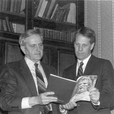
William Peterson, left, holds a copy of the "Palimpsest," the magazine of the Iowa State Historical Society, while N.P. "Sandy" Dodge V looks on. Peterson and another Council Bluffs native recently published articles about William F. Kinsman, former…
Claims of Sylvanus Dodge and G.M. Dodge

Consists of drawings made by Simons during railroad survey projects in Iowa and Nebraska beginning in 1853.
Looking South over the claims of Sylvanus Dodge and G. M. Dodge to Ferry across Elkhorn River. 1854-1858.
Looking South over the claims of Sylvanus Dodge and G. M. Dodge to Ferry across Elkhorn River. 1854-1858.
Clarinda, Iowa--File #1

Panoramic photograph including Hope Hall at the Clarinda Hospital, across a wide lawn. ca 1930?
Clarinda, Iowa--File #1

Photography of hall, main section is 4 stories with a circular portico, other wing(s) are 3 stories.
Clarinda, Iowa--File #1

Photography of flag being raised at one-room schoolhouse, with signs saying "1873" and "Goldenrod" on the front of the building, which has a cupola with a bell. Large crowd in front of building.
Clark Avenue Home One Of City's Oldest - Residence Of Mrs. Albert Peterson

Built In 1866 . . . was this brick home at 509 Clark Ave. Now the residence of Mrs. Albert Peterson, it was constructed by a pioneer Council Bluffs dentist. The two story section at the right comprised the original house.
Clark Avenue Home One Of City's Oldest - Residence Of Mrs. Albert Peterson

Comfortable Living Room . . . takes its theme from the warm combination of an attractive fireplace and big windows. Light fixture on the ceiling, now converted to electricity, has been in the room since the house was built.
Clark Avenue Home One Of City's Oldest - Residence Of Mrs. Albert Peterson

Traditional Furniture . . . in the "second" parlor fits into the atmosphere of a century ago. Mrs. Albert Peterson stands by one of her most valued articles, a hutch cabinet made of pine.
Clark, Dick and Jean

Senator Dick Clark, standing; wearing light color suit and dark tie
Clark, Dick and Jean

head and shoulders photo of Senator Dick Clark, in open-collared shirt

Class of '33 reunited; 50 years later

They couldn't find...any 1933 basketball jerseys, so former Abraham Lincoln High School athletes Matt Walsh and Ernie Olson, borrowed some new ones to pose in. Thordis Norregaard Foster assures her fellow classmates they looked just as "neat.." …
Class photograph

Unidentified group photograph of a class of grade school children.
Classroom transported to late 1800x education style

Reading From...a McGuffy's Readers is teacher Evelyn Hopper while student teacher Susan Ustohal, librarian Nancy Bledsoe (both near stove) and a group of fascinated students gather around the pot bellied stove to listen.
Cleaning House

Rolling Up Carpet . . . to prepare for waxing of the floors are Dawn Mosher and Myrtle Nichols. This carpet is in the front hall of the Dodge House. The annual cleaning of the Historic General Dodge House on Third Street makes sure that guests for…