Browse Items (9042 total)
Sort by:
Ferris wheel ride at Playland Park

Photograph of a ride at Playland Park
Ferry across the Elkhorn River

Consists of drawings made by Simons during railroad survey projects in Iowa and Nebraska beginning in 1853.
Ferry across Elkhorn River 25 miles NW of Omaha 1854.
Ferry across Elkhorn River 25 miles NW of Omaha 1854.
Festival Continues; Mo. Valley Bustles

About 40 Women And Children . . . modeled dresses, bathing suits and wedding gowns from 1871 to 1971 as part of centennial festivities. From left are Jane Lytten, Barbara Hoyt holding Jason Eckerman, Judy Colglazier, Lola Frazier, Janet Strain, Ruth…
Fierce Battle Ends For Kerns

Mike Kerns: "I never said one unkind word about my opponent. I attacked issues."
Fifth Avenue Is Given Special Recognition

This Stately Church . . . Fifth Avenue United Methodist opens its doors wide to its ever-increasing active memberships. It is most proud of its growth which has earned recognition.
Fifth Avenue Methodist

Groundbreaking Service: The Rev. Clarence Woolard turns a shovel of dirt at ground=breaking services Sunday for a new $75,000 educational unit at the Fifth Avenue Methodist church. Flanking the Rev. Mr. Woolard are Forest A. Moore, building committee…
Fifth Avenue Methodist Church

Photograph of the exterior of Fifth Avenue Methodist Church, Council Bluffs (Iowa).
Fifth Avenue Methodist Episcopal

Fifth Avenue Methodist Episcopal church, Fifth Avenue and Eighteenth street, is completing its forty-seventh year.
The church has carried on its ministry along with the development and growth of the west end of the city. It serves a large…
The church has carried on its ministry along with the development and growth of the west end of the city. It serves a large…
Fifth Generation Visitors

Two great-great=grandchildren of Gen. Grenville M. Dodge, Laurel and Lincoln Ferris, and their grandmother, Mrs. Robert Langford Montgomery, were visitors at the Historic General Dodge House on Tuesday. This was the first opportunity for the children…
Fifth Generation Visitors

Two great-great-great-grandchildren of Gen. Grenville M. Dodge, Laurel and Lincoln Ferris, and their grandmother, Mrs. Robert Langford Montgovery, were visitors at the Historic General Dodge House on Tuesday. This was the first opportunity for the…
Fifty Years & Still Cookin' Southside Christian Church 1945-1995
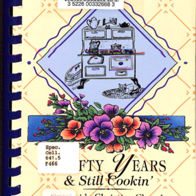
A cookbook from the Southside Christian Church.
Contains:
-Recipes from church members
-History of the church
-Photos of the church from 1945 to 1995
Contains:
-Recipes from church members
-History of the church
-Photos of the church from 1945 to 1995
Fight For Caucus nears final round

Criticizing...Vice President Walter Mondale for his comments that presidential candidates should not chastise President Carter for his actions concerting Afghanistan is U.S. Sen. Howard Baker. He spoke Thursday to the Council Bluffs Rotary Club,…
Filbert 'Not Nervous' In TV-Movie Bit Role

Louise Filbert, foreground, awaits her call to go before the cameras Tuesday morning. to her right is Jo Honaker, a registered nurse at Bergan Mercy and manager of the hospital's emergency room.
Filbert, Norman H, Jr. & Louise

Louise and Norman Filbert in a theater production.
Filbert, Norman H, Jr. & Louise

Norman Filbert 1959