Browse Items (6438 total)
- Collection: Council Bluffs Daily Nonpareil Archives
Sort by:
Flood Waters . . .
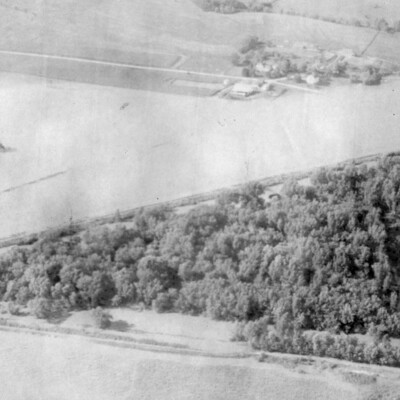
Flood Waters . . . from the Nishnabotna River north of Hamburg rolled over thousands of acres of cropland before the waters began to recede Saturday. In the center along the grove of trees is the normal path of the Nishnabotna but the waters…
Flood_of_1952_File #1

Council Bluffs, Iowa -- Five hundred Boy Scouts from flood threatened Council Bluffs and surrounding communities worked around the clock as Red Cross messengers and aids. Here a group are shown making tags to identify furniture belonging to Council…
Floods - Council Bluffs

Looking west from side of bluff between 10th and 11th Avenue (back of 3rd Street School House). Flood of April 25, 1881.
Floods - Council Bluffs

View of Council Bluffs during the Missouri River flood of 1881
Floods - Council Bluffs

View of Council Bluffs during the Missouri River flood of 1881
Floods - Council Bluffs

View of the Missouri River west of Council Bluffs during the flood of 1881
Floods - Council Bluffs

Proposed Missouri River development plan, 1971
Floods - Council Bluffs

Mosquito Creek in foreground, showing levee break into gasoline tanks farm.
Floods - Council Bluffs

Barge on the Missouri River
Floods - Council Bluffs

The Poudre in flood, looking west from the Oak Street Bridge, May 21, 1904
Floods - Council Bluffs

Looking East on Broadway from Eleventh Street, Council Bluffs, IA
Floods - Council Bluffs

Railroad switch engine pulling off stuck truck on west side of North Western RR city depot, about 4 p.m.
Floods - Council Bluffs

Flooded street, 1943
Floods - Council Bluffs

Tank farm south of Council Bluffs, flooded by Mosquito Creek
Floods - Council Bluffs

Broadway, between the North Western and Illinois Central railroad tracks
Floods - Council Bluffs

North side of Broadway, looking east from 11th Street
Floods of 1960

Flood waters surround grain bins on a farm, April 1960
Floods of 1960

On The Fence Line: Angry overflow waters from the Platte River swirl around fence posts 3 miles east of North Bend, Neb.