Browse Items (13 total)
Sort by:
Dams: $26 Million Industry - Richter Stresses Recreation Need
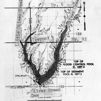
(top) Silver Creek Dam . . . south of Treynor would provide a reservoir with 2,400 surface-acres of water, if approved by the Board of Review for Rivers and Harbors in Washington, D.C.
(bottom) Graybill Creek . . . near Macedonia would be…
(bottom) Graybill Creek . . . near Macedonia would be…
Flood Waters . . .
Flood Waters . . . from the Nishnabotna River north of Hamburg rolled over thousands of acres of cropland before the waters began to recede Saturday. In the center along the grove of trees is the normal path of the Nishnabotna but the waters…
Ray Inspects Flooding; Asking Disaster Relief

Gov. Robert Ray . . . flew to Oakland Thursday to view firsthand the damage caused by flooding early this week. He talked with one homeowner, Bob Cleveland (foreground), about damage to his home. Later Ray flew to Red Oak and Corning to view flood…
Old Couple Evacuated
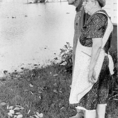
Watching The Water . . . as it slowly rises in their front yard at Oakland are Mr. and Mrs. Wayne Smith.
Disaster Team Touring SWI Flood Damage - Up To 17 Inches Of Rain
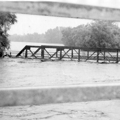
A Local Traffic Bridge . . . over the West Nishnabotna River at the east edge of Harlan is covered by flood waters. The bridge sustained similar punishment from the Nishnabotna in 1947 but continued to stand. City officials didn't feel the steel…
Nishna Valley Bounces Back From Disastrous 1958 Flood - Rapid Strides In Rebuilding
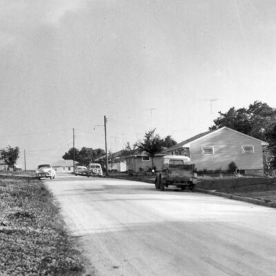
New Homes . . . replacing those destroyed in the 1958 flood now shelter 17 families in Exira. The development was made possible to a great extent by contributions to The Nonpareil's flood fund last July.
No Smiling Faces In Land Of Tragedy - Flood Waters Are Gone Now, But The Scars Tell Sad Story
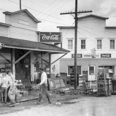
(top) Hamlin Residents . . . go about the monumental task of cleaning up the flood wrecked business district. "Sherm's Place," at right, one of the largest buildings in the community, was moved completely off its foundation by the overflowing East…
Flood Crest Moves To Red Oak; Toll Now 19 - Crop And Property Damage In The Millions
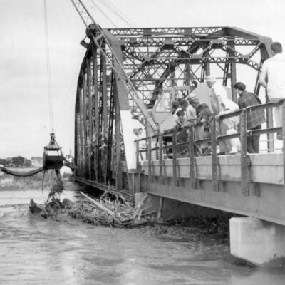
Accumulated Debris . . . is cleared from the Highway 48 bridge abutment west of Elliot. Highway crews and dragline moved into operation when debris threatened to clog the narrow opening remaining beneath the bridge.
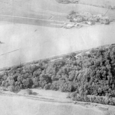
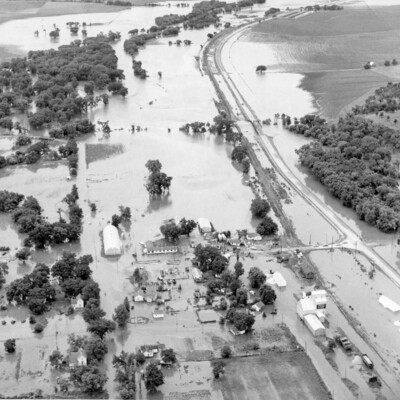
Air Views Of Flood In East Nishna Valley
Northwest Part Of Atlantic . . . was completely under water Wednesday noon, right up to Highway 6, lower right. Industrial plants, homes, trailer homes and rail tracks were inundated. Rock Island railroad grade was fast being washed away. This air…
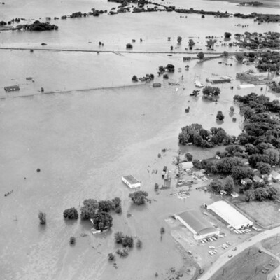
12-Inch Rain Floods East Nishna; Audubon, Exira Hard-Hit; 8 Dead
Flood Waters From East Nishna . . . ooze over Exira and Highway 71 in this air view which looks south.